Located on Quaker Ridge Road in Casco, Rolfe Hill is 400 acres of mixed woodlands, wetlands, and streams. Trail development is ongoing, with trails for walking, running, mountain biking, ATVs and snowmobiles. The land drains into Thomas Pond and ultimately into Sebago Lake, and plays an important role in safeguarding the water quality of Sebago Lake, which is the source of drinking water for over 200,000 Mainers and many Cumberland County businesses. Rolfe Hill Forest is also home to an extensive wetland system (totaling 33 acres), an associated trout stream, and at least 1.25 acres of vernal pools.
We ask all visitors to observe the use guidelines.
Access Information
Parking & Trailhead Location:
559 Quaker Ridge Road, Casco, MaineThere is an off-street parking area suitable for approximately 10-15 cars. The parking area is plowed for winter use and has an information kiosk with maps and use guidelines. You must cross Quaker Ride Road to access the trail system. Please use caution.
Access to this land and trail network is free. If you would like to support the stewardship of Rolfe Hill Forest, please consider a
donation to Loon Echo Land Trust.
Use Guidelines
- Carry in, carry out
- Dogs must be under control at all times
- Hunting is allowed
- Snowmobiles and ATVs allowed on designated trails only
- No fires, no camping or overnight use
- No target shooting or prospecting
- Be respectful of plants, animals, other visitors and neighbors.
Trail Development
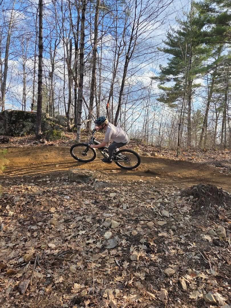
Phase 1: Mt. Abram Trails built a 0.7 mile downhill, intermediate level flow-tech mountain bike trail in fall of 2025. That trail was funded with $30,000 raised during the acquisition campaign to purchase and conserve Rolfe Hill Forest, and a $20,000 grant from the Maine Mountain Bike Trail Fund. This new trail, named "Landlocked" in honor of our local landlocked salmon fishery, was opened to the public in May 2026. Portions of the trail are still under construction but the upper 2/3rds are open. This is a downhill only mountain bike trail and is not intended for use by pedestrians. The trail includes bike park style features such as jumps and berms however all features are optional or have ride-arounds.
In 2026: LELT was awarded $142,000 from
Maine Trails Program to build another 2.5 miles of mountain bike and pedestrian trails at Rolfe Hill in 2026 - including a 0.7-mile loop built to adaptive bike standards and suitable for beginner mountain bike riders and pedestrians, and three more downhill mountain bike only trails. Additional support for this phase of construction includes $10,0000 from onX Maps and private donations.
Check out the Project Map Here
History
Rolfe Hill Forest was purchased from the Rolfe Family in early 2024. The land had been in the family since the 1700s and was home to the first homestead in Casco, the Gay Family homestead. Rolfe Hill is within the traditional and unceded territory of the Abenaki, a member tribe of the Wabanaki Confederacy. The Abenaki First Nations of Odanak and Wôlinak maintain reservations along the St. Francis and St. Lawrence Rivers in the Canadian province of Quebec, where they sought refuge following colonial warfare in the Saco, Presumpscot, and Androscoggin River watersheds during the 17th and 18th centuries.
Rolfe Hill has long been used by the Casco community for ATVing (club trails), snowmobiling, hunting, hiking, snowshoeing and skiing. Public access to the property is now permanently secured, and LELT plans on developing more trails and continuing to improve public access.
Conservation
This property was conserved with financial assistance from the Maine Natural Resources Conservation Program (MNRCP). MNRCP was created to manage the allocation of funds collected through Maine’s In Lieu Fee Compensation Program, and awards competitive grants to projects that restore and protect high priority aquatic resources throughout Maine. Additional funders for the project include The Nature Conservancy, Portland Water District, onX Maps, Casco Bay Estuary Partnership,
Sebago Clean Waters, Davis Conservation Foundation, Ram Island Conservation Fund, The Conservation Fund in partnership with the Stifler Family Foundation, an anonymous foundation, and Lake Region community members.


%20(1).png)